By Brian Hall, President & CEO GDM Inc.
Across Western Canada, pipelines and people are converging faster than policy can adapt, forcing municipalities, operators, and Indigenous nations to rethink energy infrastructure not as assets to manage, but relationships to steward.
As communities expand and energy demand rises, Western Canada’s 1643 municipalities face the challenge of balancing urban development with the responsible management of energy infrastructure. Clear, accurate data on municipal boundaries and our vast infrastructure is essential; not only to understand where communities are growing, but also how that growth intersects with vital infrastructure such as pipelines, roads, wells, and facilities.
From British Columbia to Manitoba, our infrastructure is expansive:
| Facilities | 230,034 |
| Wells | 886,964 |
| Pipelines | 485,170 |
| Pipelines in KMs | 695,542 |
Source: GDM Inc.
For municipal planners and infrastructure operators, the stakes are high. Urban sprawl brings people closer to energy networks, and this encroachment can trigger class location changes that demand new safety and compliance measures.
Municipalities need visibility into which companies are moving production through their boundaries, how that affects environment, health, and safety, and what revenues should rightfully support their communities through taxation. Energy companies, likewise, must stay ahead of these changes to maintain safe operations while fostering trust with the people living and working nearby.
And as infrastructure ages, Municipalities and Operators face significant challenges with managing end-of-life assets.
GDM’s Municipal Boundaries data layer in our asset intelligence and integrity solution Converge, combines infrastructure insights with population growth patterns so municipalities and energy companies can work from the same source of truth, ensuring communities are built with foresight, safety, and fairness.
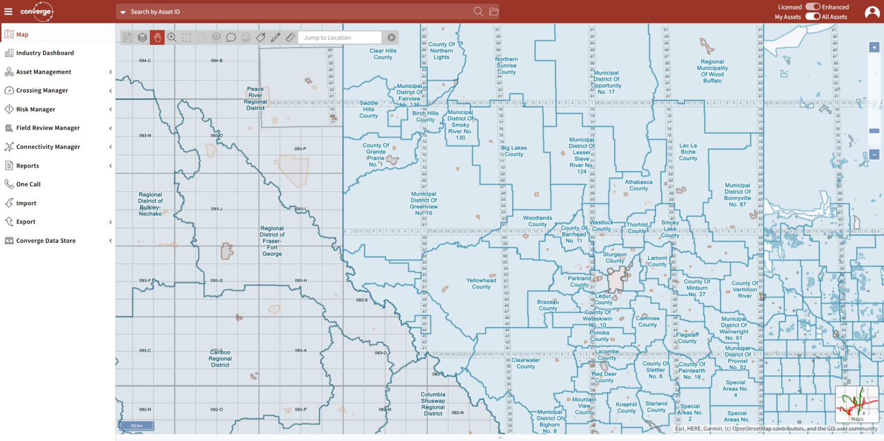
Municipal Boundaries in GDM Converge
Land designation, specifically whether it’s Crown or freehold, doesn’t directly influence the technical aspects of pipeline integrity. However, it significantly impacts the regulatory processes, land access, and a pipeline’s class location, which in turn affects safety and integrity management.
The process for obtaining access to land for a pipeline project differs significantly between Crown and freehold. A company must negotiate a right-of-way or easement agreement with the freehold landowner, while it must obtain a disposition or lease from the government for Crown land.
These differences in access are tied to the legal framework but don’t change the physical engineering requirements for pipeline integrity. Pipeline integrity is governed by provincial or federal regulators regardless of who owns the surface.
The dilemma is a two-way street for operators and communities. On one hand class location impacts current and future land use. It can determine setbacks or restrictions on construction near a pipeline, which can influence how that land is developed and documented in future land titles or municipal plans. On the other hand, surface title changes that prompt increased occupancy or development could trigger a location change that mandates pipeline reassessments.
This causality dilemma requires all stakeholders to curate and maintain accurate, current data and information management systems to assess, plan, predict and avoid a costly and potentially life threatening “collision”.

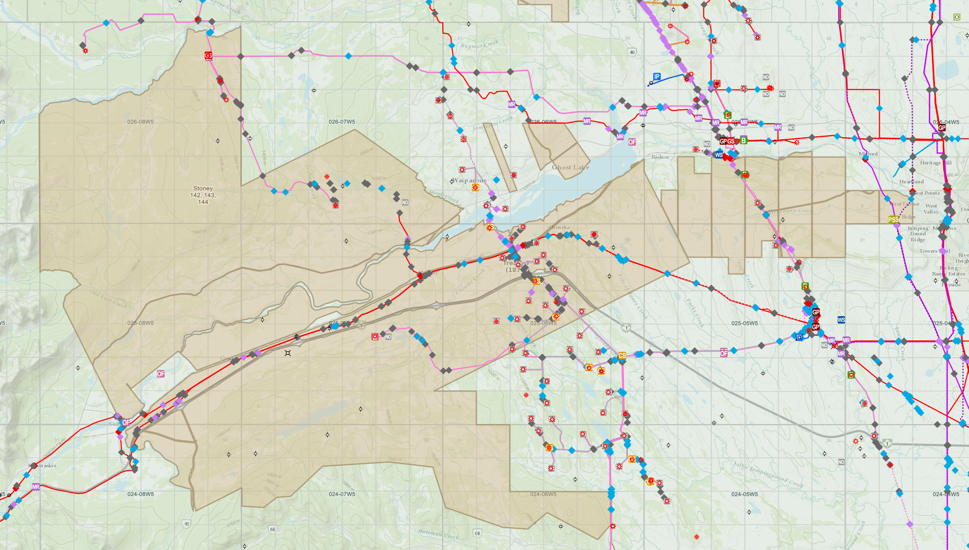
Crown Freehold surface data layer in Converge
Energy infrastructure has always been more than steel and rights-of-way. It is a web that touches homes, ecosystems, and economies. In Western Canada, the physical footprint is immense: hundreds of thousands of facilities and wells and 700,000 km of pipelines knit through rural and urban landscapes. We know municipal growth is converging with energy networks, raising questions about safety, taxation, compliance, and end-of-life asset management. Yet to fully navigate this intersection, we must also elevate Indigenous communities.
Indigenous communities are stakeholders, rights holders and essential partners because they hold constitutionally protected rights, title, and jurisdiction over lands and waters, making collaboration a legal and ethical necessity. Generations of land stewardship provide invaluable ecological knowledge that improves project design and environmental outcomes. Agreements built on collaboration ensure long-term community well-being that balance costs and benefits through revenue sharing, equity participation, and local workforce strategies. Essentially, trust-based partnerships accelerate project timelines by reducing conflict, litigation, and permitting delays. The result creates more resilient and efficient operations.
A new operating model shifts Indigenous engagement from regulatory compliance to collaboration by co-designing value across five layers. First is co-planning, where shared tables with Indigenous governments shape routes and priorities early. Shared data and visibility ensure all parties work from a common geospatial platform that includes Indigenous land and cultural sites. Shared benefit and equity mechanisms reshape agreements to include revenue sharing, equity stakes, and Indigenous-led ventures. Co-management and shared oversight embed Indigenous leadership in environmental monitoring and governance boards for cumulative effects and restoration. Finally, shared accountability to deliver professional development and workforce pathways that create lasting careers through training partnerships, apprenticeships, and digital skill development.
Indigenous land layers in Converge in Alberta.
Pipeline class location isn’t a regulatory checkbox. It’s a lens through which safety, community density, and operational risk intersect. As municipalities expand and Indigenous territories assert governance, class location designations become a critical factor in route planning and integrity management. Higher class locations, driven by population proximity, demand enhanced design standards and monitoring, which amplifies the need for collaborative planning. When Indigenous lands and municipal growth are integrated into platforms like Converge, operators can visualize class location shifts alongside cultural and jurisdictional boundaries—ensuring compliance, optimizing routes, and safeguarding communities. In short, class location isn’t static; it evolves with people, parcels, and partnerships.
From pipelines to partnerships, the future of energy infrastructure depends on more than steel and engineering, it hinges on trust, shared vision, and respect for rights. Indigenous leadership isn’t a checkbox; it’s a catalyst for innovation, resilience, and sustainability. When collaboration becomes the norm energy projects are no longer transactions. They become legacies spun together with the land, the communities, and the generations that follow. The question isn’t whether we can afford to partner, it’s whether we can afford not to.
Technology is the bridge between vision and action. GDM introduced Indigenous Lands data layers in Converge to visualize Indigenous lands alongside energy networks with unprecedented clarity. This isn’t just about maps—it’s about transparency, shared decision-making, and honoring rights by making them visible in every planning conversation. When Indigenous territories are integrated into the same digital ecosystem with pipelines, wells, facilities, roads, electrical networks, data centers, or whatever, collaboration becomes tangible: routes are optimized, cultural sites are safeguarded, and trust is built on data everyone can see.
Ultimately, the future of energy infrastructure will be decided not only by where we build, but by how we choose to build together. As municipalities grow, land tenure evolves, and Indigenous governance is rightfully centered, the common thread is the need for accurate data, shared visibility, and collaborative decision-making. Working from a single, trusted source of truth, means energy infrastructure is safer, more resilient, and more equitable. Growth is no longer a collision course but a coordinated effort that respects people, protects the land, and ensures energy systems remain a responsible legacy for future generations.
ABOUT GDM
GDM Inc. is the trusted source for energy infrastructure data in Canada. In business since 1997, GDM is relied on by industry to deliver the most complete, accurate, and current pipeline and facility, environmental incident, transportation infrastructure, utility, and frontier land data. Our data is available as part of prominent industry applications Converge, AccuMap, and geoSCOUT, in addition to being accessible via direct database connections like Snowflake and GIS-ready files.
To round out our offering, our proprietary software application, Converge, offers analytics and mapping tools, as well as modules specific to pipeline risk assessment, water crossing prioritization, and asset connectivity. We also deliver custom data reporting and analytics services to meet the unique and changing needs of the energy industry in Canada.
For more information about GDM’s solutions, visit www.gdm-inc.com